Wetland Surveying and Mapping
- Page: Wetland Surveying and Mapping
Wetland maps are a prerequisite for wetland inventory and for wetland development planning, management, protection, and restoration. Maps provide information on wetland type, location, and size. These maps are used by Local, State, and Federal agencies, as well as by private industry and organization. They are used for many purposes, including the development of comprehensive resource management plans, environmental impact assessments, proposed construction buffers, natural resource inventories, habitat surveys, and the analysis of trends in wetland status.
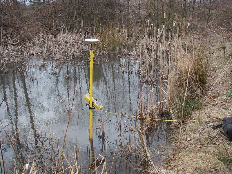
The boundary of the wetlands is determined by a trained biologist observing the soil types, vegetation, hydrologic indicators, and reasonable scientific judgment. Typically numbered blue or pink colored flags are then placed in key locations to denote the boundary of the wetlands. These flags are then roughly mapped by the biologist. He then provides the surveyor with this rough map including number of flags and high water marks shown. The surveyor then accurately locates the aforementioned flags and marks. The surveyor draws a map to reference the boundary of the surrounding plots or parcels of land. A chart is added to the drawing providing flag numbers and state plane coordinates for future reference.
For more information in about Wetland Surveying and Mapping in Whatcom County, WA – its processes, requirements and other important matters that you need to know, we at Northwest Surveying and GPS are ready to assist you.
You may use the contact details below to reach us.
Why Should You Choose Us
Utilizes Latest Technology
We utilize the latest technology to provide a Incorporating state of the art computers and software in our office production.
37 Solid Years in Service
Northwest Surveying & GPS, Inc. is a solid 37 years old local land surveying company committed to serving the people of Whatcom County.
3,300 Record of Surveys
3,300 Record of Surveys and over 250 Short Plats recorded in Whatcom County
Our company is dedicated to delivering the people of Whatcom County a quality product for a reasonable price.
Northwest Surveying & GPS, Inc. was founded by Denny DeMeyer in 1984. Denny is a lifelong (67 year) native of Whatcom County, graduating from Ferndale High School in 1967 and Everett Community College with an Associate Degree in Forest Technology in 1969. He passed the land surveyor’s exam and received his surveyor’s license in 1983. Denny is now retired and his son, Jeromy has purchased the company.
Northwest Surveying & GPS, Inc. is a solid 37 year old local land surveying company committed to serving the people of Whatcom County with over 3300 Record of Surveys and over 250 Short Plats recorded in Whatcom County